Relocation: New Jersey to California - March 3, 1995
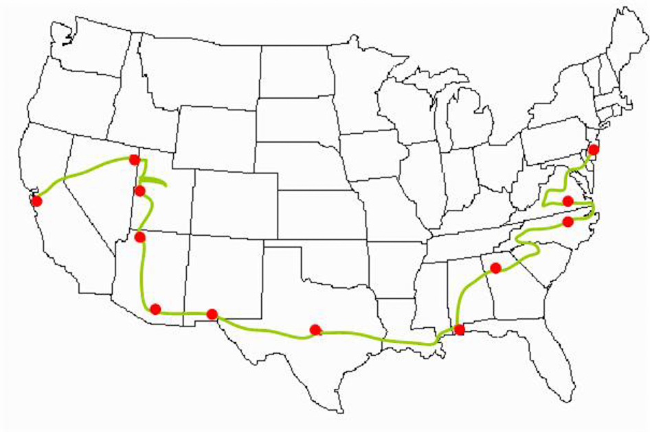
My trip back home to California after spending a year working in Southern New Jersey. As you can see from the blue-line on the map, I didn't take the direct route! I have illustrated many of the stops with photos that I took along the way. I hope that you enjoy this tour.
Day 1 - Friday, March 3 - Marlton, New Jersey to Richmond, Virginia
Start: Marlton, New Jersey [0]
End: Richmond, Virginia [419]
Distance driven: 419
It was a dreary, rainy day leaving New Jersey, but my heart was light … I had escaped. After a long search I had found my way out and was headed for a new job in the "west". The last insult from New Jersey, as some fellow trapped friends pointed out, is that you have to pay to leave the state -- every exit from New Jersey is a toll gate.
As I crossed the Del Mem Brdg (the Delaware Memorial Bridge, for those of you that don't read New Jersey'ese road signs), I heard a tussling in the maps on the passenger seat, as I entered Delaware, I heard a sound like a "pfittt" and small cloud of vapor escaped from those maps. Later when I got a chance to look at them, all references to New Jersey had disappeared. On the US map, there is a small white area, in my road atlas there are 2 empty pages - New Jersey had ceased to exist.
I hopped on the turnpike at that point and headed south, the goal for today is to drive the Shenandoah Valley, Skyline Drive, and get to Charlottesville. As I headed south, the weather started to improve, clouds started to part, and by the time I arrived in DC it had turned into a nice day. From DC I started to head west -- the farther I got from DC, the more the clouds came back, by the time I arrived at Front Royal and the entrance to the Shenandoah Valley it had become a storm threatening day again.

Leaving New Jersey
Shenandoah National Park, Virginia
Skyline Drive was completed in 1939 for a length of 105 miles. The park and road never close for the winter, but during and after periods of bad weather, portions may be closed temporarily.
The ranger at the park gate indicated that the north section of the park was closed after the first 5 miles due to ice and snow. They had had a storm come through the night before and it had left more snow. She indicated that I could drive that first section, but that I would have to turnaround and enter the park towards the middle at highway 211. It turns out there are 2 major roads that divide the park into thirds, and that I would be able to drive the middle third if I wished.
I took the ranger's advice and took the quick drive into the section she had open. The overlook she had indicated, wasn't that great due to the clouds, but as I got to the end of the road, there were several deer grazing alongside the road. There was no sign of snow or ice on this section, but the road was closed anyway. I turned around and headed back out of the park to drive the valley route along Highway 340 to Luray.
Driving the valley route allowed me to see where the people lived and worked in the area. As I started to enter the park again, I started to climb the mountains again. The roads were perfectly clear until I hit the entrance of the park and started to see scattered patches of snow on the ground. After paying my entrance fee at Thornton Gap and proceeding into the park, the snow became much heavier on the ground and there was a slight drizzle. As I passed through the Mary's Rock Tunnel and came out the other side, the light filtering through the trees with a light dusting of snow was an incredible sight. All the plants had this slight frosting that was backlit from this position and it was a fairyland.
There must be a spectacular view from this road, but this day the distant mountain tops were shrouded with clouds and only a portion of the slopes were visible. The road through the park was a beautiful drive, areas that climbed and dipped and then sections that were laid out by a snake. I did encounter a few people on the road, but for the most part it was all mine.
I decided not to try and drive the bottom third of the park, because of the weather and left the ridge route at Swift Run Gap entrance and headed for Charlottesville and Jefferson's Monticello. I found the Thomas Jefferson Visitor Center first. The center contains artifacts found in excavations at Monticello and various other objects and interpretations of Jefferson's influence in the area.
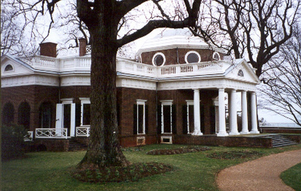
Monticello, Charlottesville, Virginia
I then proceeded up the hill to Monticello (little hill). Admission to the house is $8.00. If you give the attendant a $10.00, they'll give you back a Jefferson $2.00 bill -- a nice souvenir in itself. I arrived about 4:00 p.m. and the weather was still cloudy and chilly. We huddled around a fire pit while waiting for the bus to take another group to the house.
The interior of the house is shown as a group and no photography is allowed inside. I was impressed by how small the actual building was. This was a very livable design, even by today's standards. True, some of the rooms were smaller than we are used to, and the stairways are almost nonexistent because Jefferson thought the large ornate stairwells of his time were a waste of space. Because the stairwells are so narrow, the tour is restricted to just the first floor.
I enjoyed seeing the gadgets that Jefferson had built into the house:
- Giant pendulum clock that also indicated the day of the week
- Wind direction indicator on the ceiling of the porch, tied to the weather vane
- Double doors linked together so that opening one opened both
- Dumbwaiter built into the mantle of a fireplace
- Pivoting door in the dining room with shelves to allow efficient clearing of the room
The architectural features that I enjoyed included:
- Small greenhouse attached to the library -- very inviting with its view and the collection of citrus and exotic plants
- The built-in beds, in particular Jefferson's, built into the dividing wall between his study and bedroom -- those feather beds look very soft and fluffy!
- The dining room with all the built-in gadgets, and its attached tea room with all the windows and glass dividing doors
In all, Monticello would be a very livable house today (it would need some indoor plumbing and electricity though). The cellars, kitchen, privies and stables are all contained under the back deck. These rooms are separate from the main house, but can be reached through covered walkways to the main house.
After my visit at Monticello, I headed east to Richmond where I planned to stay the night. I didn't expect any trouble finding someplace to sleep, but unknown to me, the races were being held that weekend (that's car races) and many of the motels were already booked with teams and fans.
Day 2 - Saturday, March 4 - Richmond, Virginia to Raleigh, North Carolina
Start: Richmond, Virginia [419]
End: Raleigh, North Carolina [918]
Distance driven: 499
This morning started out with a wonderful pancake breakfast at a local restaurant. I had to decide between visiting Colonial Williamsburg or seeing the Outer Banks of North Carolina. I decided to go for the Outer Banks, figuring that Williamsburg is more accessible and would be a possible trip the next time I'm in the DC area. The Outer Banks are the home of Kitty Hawk and the Cape Hatteras Lighthouse.
The drive to Kitty Hawk was very colorful. The hills and roadways are multi-hues of green. The direct route takes me across the Chesapeake Bay at Hampton Roads, where the Monitor and Merrimack fought. There is a bridge that takes you across the bay and into North Carolina.
Being from California, I had an impression of what the beaches and the drive out would be like, but I was in for a surprise. Most of the drive out was through forests, but the signage laws are different than what I'm used to. Driving into the many small towns, there would be hundreds of billboards advertising restaurants, hotels, attractions, and why they were the best town to stay in. Once I got to beach I was surprised to see that I was on the backside of very large barrier sand dunes so that there wasn't much to see in the way of water and waves.
This was also the off season for this area, so the villages of the Outer Banks were pretty well deserted with signs advertising when different businesses would be opening. The biggest surprise here is that all of the housing is built on stilts. There are no homes with first floors, this seems to have freed the designers to come up with some wild floor plans in these primarily summer dwellings. Another reason to have the houses on stilts was to be able to see over the sand dunes and to handle the high seas.
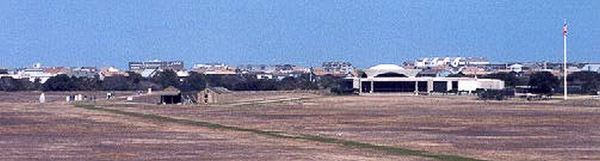
Wright Brothers National Memorial, North Carolina
One thing I have never seen or heard about as being a difficulty for the fliers was something called the "prickly pear". This fruit is about the size of a man's thumb and has many one inch long spines. Simply walking across the lawn in this area was dangerous enough without crashing into these things.
Inside the visitor center are displays about how the brothers worked, how they developed the instruments to measure the efficiency of their designs and a replica of the actual Wright Flyer.
Even with all of the buildings that surround this site, being the off season, I get some sense of the emptiness of the area that the Wright brothers must have been working in that December. There are pictures of them visiting the local lifesaving station - about the only other people that stayed in the area.
Visitor Center
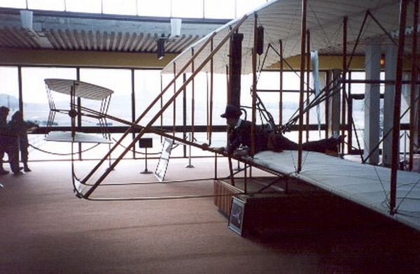
Wright Flyer display in the visitor center
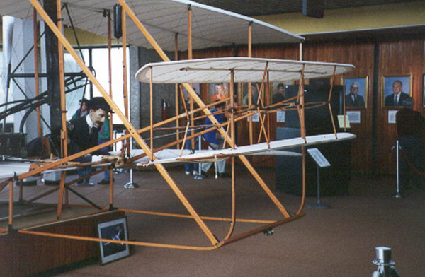
Wright Flyer display in the visitor center
Cape Hatteras National Seashore, North Carolina
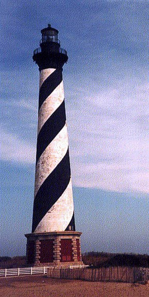
Cape Hatteras supports 3 lighthouses; all three are unique. There is a visitor center here that explains some of the history and tradition of the island. Before the Coast Guard was introduced, there were lifesaving stations along the coast here. The lifeguards would walk the beaches looking for people or wreckage to indicate that a ship had gone down off the coast. During World War II there was German submarine activity off the island and attacks could be witnessed from the shore.
Although this is a National Seashore, there are many sections where private residences can be found and several villages as well.
There are two ways off the islands here, either backtrack the road I had taken in or take a 2.5-hour ferry ride. I opted to backtrack and head for Raleigh. The way out led me through many swamps and small towns until I finally reached my destination. Along the way, I noticed signs that indicated to watch for Red Wolves and Geese, unlike the "normal" deer crossing signs that you see elsewhere. Later that night in the hotel I caught a news report that indicate the red wolves had been reintroduced to the area the year before and that they were having troubles with farmers hunting them down.
Day 3 - Sunday, March 5 - Raleigh, North Carolina to Atlanta, Georgia
Start: Raleigh, North Carolina [918]
End: Atlanta, Georgia [1406]
Distance driven: 488
Today starts with fighting Raleigh's morning commute in a light drizzle. About three-fourths the way around the beltway there was a fender-bender in the fast lane. After having spent a year in New Jersey with the world's most creative and worst drivers, it was quite a surprise to see people merging into the other lanes almost a mile before they actually had to, and no one raced past the merging traffic to gain that extra mile either!
The drive today takes me through the hills of North Carolina. A newspaper I picked up talked about how Hollywood has discovered North Carolina. Daniel Day-Lewis was here filming The Last of the Mohicans, and Richie Rich was filmed at the Biltmore. This is beautiful country between the towns and gentle rolling hills that rolled on until I reached the mountains and the Blue Ridge Parkway.
I stopped in at the Folk Art Center outside of Asheville on the Blue Ridge. This combination visitor center and crafts store is well worth the visit for both its interpretive information and the chance to shop. From here I proceed to my main destination of the Biltmore Estate.
Biltmore Estate, North Carolina
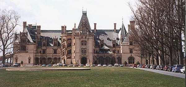
As you pull on to the grounds, you have to stop at the brick gatehouse and purchase a ticket to visit the estate. After showing my ticket to the guard at the gate, I continue my drive on to the "big house". It is a 3 mile drive up the drive-way before you get to the main building. The estate is heavily wooded on a series of hills, with the house on the highest point.
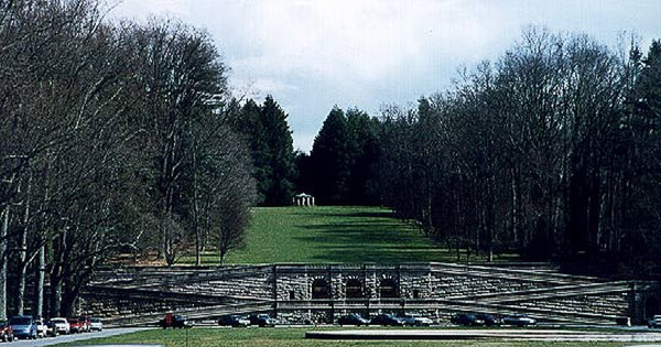
As you pass through another set of gates, and turn into the final drive-way, you see the house. It is huge -- it dominates your view from across a lawn and fountain. Opposite the house and behind me is a vista garden with great opposing staircases leading up to the garden gazebo in the form of a Greek temple.
The scale of this place is huge, unlike Monticello that felt very livable and homey, this has the feel of a fine hotel with as many rooms and services as you would expect. As I enter the entrance hall, the ceilings just melt into the great height of the room. There is much activity as "spring cleaning" is in full swing today. Some of the rooms have been stripped of their furniture and it is in this common area between the rooms. The feature of the house that most impressed me was the winter garden just to the right of entrance. This is an indoor garden with a glass roof and heavy wooden timbers. This indoor terrace was the most welcoming site that I found with its ferns and tiled floor.
The Biltmore Estate was built by George Vanderbilt, son of Cornelius the railroad baron. Richard Morris Hunt was the architect and Frederick Law Olmsted (designer of New York's Central Park) was the landscape architect. This was one of the many houses that the Vanderbilt children would construct, and it is very grand. George was a collector of books, art, and furniture, and this house is as much a showcase for that collection as it was a home for his family.
Most of the house is open for a self guided tour, you aren't allowed to take pictures inside the building. An optional guided behind-the-scenes tour is also available. The first floor consists of dining rooms, library, billiard room and music room. On the second floor is the great living hall and the bedrooms with their adjoining servants quarters and sitting rooms.
Downstairs are the kitchen, laundry, pantries, trunk storage room, indoor pool, bowling alley and gymnasium. This is backbone of the house. Also in this area is an entire room for storing baskets, vases, and materials for flower arrangements. As a hideaway for the boys, there is the smoking room and gun room with the required trophies on the wall.
After my visit in the house, I head back down the hill. The estate is a small community. The gardens are decorative, but there are also farm land and originally a dairy. In addition to the Vanderbilt family house, there are other residences for the caretakers of these enterprises. I head on out, over the Blue Ridge and enter South Carolina with a final destination of Atlanta. Along the way, I was surprised by the number of automobile factories along the route I took -- Volvo and BMW both had assembly plants here in the South.
Day 4 - Monday, March 6 - Atlanta, Georgia to Mobile, Alabama
Start: Atlanta, Georgia [1406]
End: Mobile, Alabama [1800]
Distance driven: 394
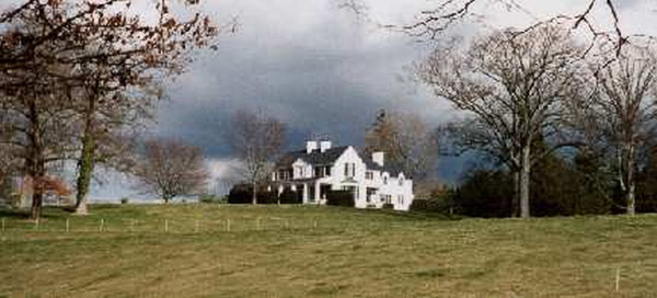
Today starts out as an overcast dull sort of morning. I hopped into the morning commute and headed around the beltway passed Atlanta. I have finally gotten far enough south that I have found spring. There are several types of trees that are blooming along the highway. There was a dark purple, pink, and white variety of these trees that I had never seen before.
The drive south is rather stormy. I find spots where it wants to rain and others where the wind is blowing like crazy. I was listening to CDs in the car until I got closer to Mobile, when I turned the radio on. Announce said that there was a tornado and severe thunderstorm watch for the rest of the day and that towards that northern part of Alabama there were reports of touch-downs. Heck! to me it just looked like a normal May day in San Diego. Not knowing what to expect, I decided to cut the driving short today and see the sights in Mobile.
USS Alabama (BB60), Mobile, Alabama
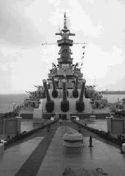
Having grown up in San Diego, I have been on tours of different Navy ships, but I had never been aboard a battleship and this was my chance. This ship is open for self-guided tours and they issue you a map of the ship with a recommended path and there are helpful arrows on the walls and decks to help keep you on the path - but you still get lost and turned around.
One of the more interesting features of a battleship is the guns and these are open for your viewing. You can literally crawl up into the main batteries and a special feature is that one of the barbettes has been modified so you can see how the shells and powder are moved from the powder room and magazine up to the big guns. It turns out that part of Steven Seagal's Under Siege was filmed on board this ship.
On the way into Mobile I had passed a barbecue joint. You know how I could tell? They had a smokestack that let the smell of those ribs pass over the freeway. This was the most wicked advertisement that they could have come up with. I headed back to this location for dinner. Dreamland turned out to be the name of the place and their motto is "No slaw, no beans, no potato salad. Don't ask! Ain't nothing like'em nowhere." All they had was ribs and beer. And when you order the ribs, they bring you a basket of good'ol WonderBread.
Despite the weather report, the afternoon had been fine just a little humid and overcast. But by the time I had finished my slab or ribs it had started to rain. When I say it rained, I mean they opened all the valves and it just poured down in rivers. I found myself a hotel to stay in and just the short walk to the office left me soaked. My last experience in Mobile had to do with some very large mosquitoes. I don't know how they got into the room, but just as I was getting ready to go to bed, I found these guys. I spent the next hour swatting mosquitoes before I finally could go to bed. It's a good thing I found them, because they would have bled me dry by morning.
Day 5 - Tuesday, March 7 - Mobile, Alabama to San Antonio, Texas
Start: Mobile, Alabama [1800]
End: San Antonio, Texas [2490]
Distance driven: 690
Today is a travel day. Today I want to get well into Texas, and there isn't much along the way to distract me. Traveling through Louisiana is a series of very long raised highways through bayous and swamps. I decided to drive through New Orleans. It is a week after Mardi Gras and there are still signs up for where to get your beads and costumes. After passing through the downtown area you can catch sight of a cemetery with raised marble graves.
Cruising through Louisiana was fun, but as I hit the Texas state line and saw the sign indicating that El Paso (the other side of Texas) was 895 miles away, I almost gave up. Texas is a big state! The eastern half that I am going to cover today has rolling hills and forests for most of the ride, as you get closer to Houston the landscape flattens out into grasslands.
Day 6 - Wednesday, March 8 - San Antonio, Texas to Deming, New Mexico
Start: San Antonio, Texas [2490]
End: Deming, New Mexico [3200]
Distance driven: 710
Today's goal is not to spend another night in Texas. The western half of Texas continues with the grasslands, but the terrain turns into canyons and rock walls. As I drive through El Paso, I see what looks like a standard town, but as I get to the west side and look across the river, I could see Juarez -- and there is a dramatic difference with its crowded hills and foundry belching smoke into the evening sky.
I planned to spend the night in Las Cruces, New Mexico, but when I talked to the hotel desk they told me that the entire town is sold out for an RV Industries convention. I decide to continue on to Deming. The highway through Deming and its streets are aligned east and west. As I pull into town I'm blinded trying to read signs and find a hotel for the night.
Day 7 - Thursday, March 9 - Deming, New Mexico to Tucson, Arizona
Start: Deming, New Mexico [3200]
End: Tucson, Arizona [3464]
Distance driven: 264
Today starts with a visit to Rockhound State Park outside of Deming. This is an area maintained by the state for people to actually come out and collect rocks. It's a low-services area, with some campgrounds at the base of a hill.
I stayed here for about 2 hours crawling over the hill. There had been recent rainstorms, so there were newly washed-out areas to explore. I found some jasper and bauxite, and a whole bunch of other rocks that looked interesting.
I then continued my travels and headed for Tucson. My first stop was Kitt Peak and all the telescopes, especially the unique solar telescope. The drive to Kitt took me to the western side of Tucson and around the edges of Saguaro National Park. I arrived about 5 and all the buildings and visitor center were closed, but I got to see the view and take the following pictures.
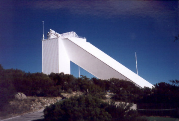
McMath-Pierce Solar Telescope
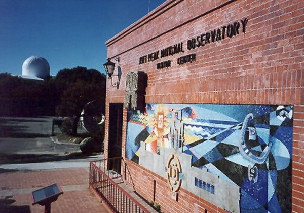
Visitor Center
I stopped by the Mission San Xavier, but it was after visiting hours and they were also busy setting up for a Pow-wow that was being held this coming weekend.
Day 8 - Friday, March 10 - Tucson, Arizona
Today I visit the Arizona-Sonora Desert Museum and back to Kitt Peak to try and get inside a couple of the observatories. The Desert Museum is a zoo and garden set on the side of a hill overlooking the Arizona Desert. Today looks like a stormy day -- it hasn't rained yet, but the wind is blowing something fierce.
I start the drive back out to Kitt Peak with intermittent rain showers and lots of wind. The drive up the mountain quickly becomes fog enshrouded. It is wet and miserable at the top, but having seen the view and exteriors yesterday, I still wanted to see the workings of the Solar Telescope.
Day 9 - Saturday, March 11 - Pima Air and Space Museum, Tucson, Arizona
Today starts with a tour of Sabino Canyon. This state park is at the edge of Tucson with new housing built right up to the entrance, but once inside you are in a different world. The canyon works its way up about 1,000 feet into the hills and has a river running in the valley with steep rocky sides. The canyon is a blaze in color with wildflowers blooming and the trees in green. The river is flowing over its banks in a couple of spots because of all the rain they have had here. There is a choice of walking (or jogging) on the paved trails or a quick guide tram ride to the top.
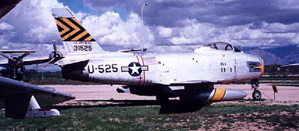
Tucson is one of the places that is used for storing old jets. Near the center of town is the Air Force base, packed full of primarily Vietnam-era jets, but you will also find many F-16s in storage. Alongside the air base is the Pima Air and Space Museum. This is acres of land with 4 hangers full of planes. There 300 items on the open grounds and many more inside the hangers.
There is a wide variety of materials here from WWII and on. There are the Russian MiGs alongside their adversaries, the Thunderbolts from the Korean War. There is a wide variety of experimental planes and transports.
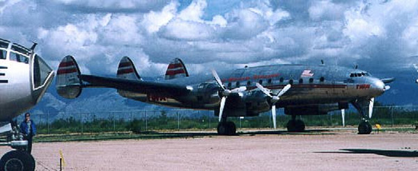
This museum has much in the way of the unusual and the one-of-a-kind. There are a few passenger planes and their military versions like this Constellation. As well as displays with a B-17 and B-29. Be sure to leave plenty of time to walk the grounds and see all the displays, also be prepared for the heat and bright sun!
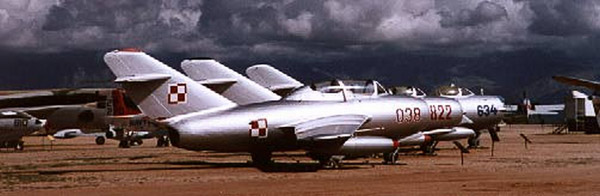
Mig jets on display
Day 10 - Sunday, March 12 - Tucson, Arizona to Flagstaff, Arizona
Start: Tucson, Arizona [3464]
End: Flagstaff, Arizona [3777]
Distance driven: 313
This was a short drive that I started a little late. As I passed through Phoenix I could see rainstorms to the sides of the freeway, but nothing was really bothering my drive. I drove Sedona to see what this area was all about. The drive through Sedona of course is very scenic. This is some of the darkest red rock that I have seen and you are following a stream running in the valley. One of the tourist signs that you see along the way points out that Sedona is the home of the only teal colored "Golden Arches" at the local McDonald's.
After passing through the red rock, you get into a more forested area and start to climb back out and up to Flagstaff. Water was flowing freely through the valley, but as I reached the top of the canyon, I found snow along the roadside.
Day 11 - Monday, March 13 - Flagstaff, Arizona to Cedar City, Utah
Start: Flagstaff, Arizona [3777]
End: Cedar City, Utah [4110]
Distance driven: 333
Today's ride should be one of the more spectacular as I drive through northern Arizona into Utah crossing over Glen Canyon and on into Zion National Park.
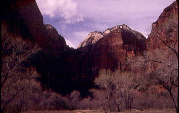
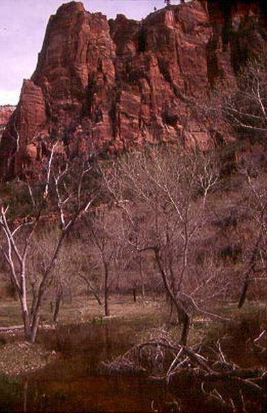
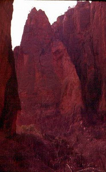
Zion National Park, Utah
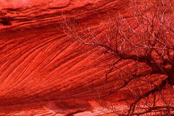
Entering Zion from the east is the less settled side. After entering the park you see sandstone formations and streams. After passing through the sandstone, you enter the tunnels that make up the long tunnel. This tunnel is so narrow that RVs and other wide vehicles have to be escorted through.
The actual park portion of the drive is a spur to the north. It is along this road that the actual park attractions are found. The Virgin River flows along the road that takes you into the park. It was still not quite spring in Zion, there were a few trees that were budding but most were still bare.
Day 12 - Tuesday, March 14 - Cedar City, Utah to Wendover, Nevada
Start: Cedar City, Utah [4110]
End: Wendover, Nevada [4619]
Distance driven: 509
Today I continue through Utah and into the last of the national parks I'll see on this trip. I get an early start and head out for Bryce. I have to cross over a range of mountains to get there. This area is where Brian Head is located. I have the road to myself and as I start into the mountains I pick up snow. This stuff is fresh and unmarked, with sections where it still clings to the trees. It's quiet up here and the sky is clear.
Once I get over the mountains, I continue north. This section of the road travels through several reservations, and every few miles I pass roadside stands for jewelry and blankets. Most of these aren't open, but a few diehards have managed to open some of the stands.
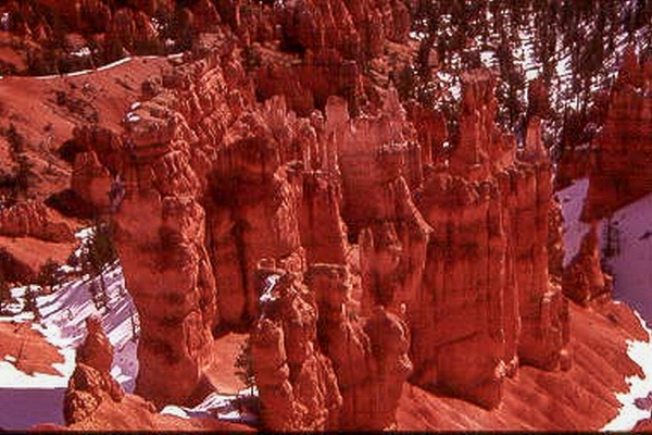
Bryce Canyon National Park, Utah
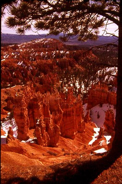
Unlike Zion, Bryce has a coating of snow and the trails are closed because of ice. The road into the park is also closed, but that is due to improvements being done to the road. This construction is supposed to be finished by this fall and will allow access to the full park for the first time in several months. Bryce is known for its hoodoos. These are free standing sandstone formations that have been created by wind and water. The following pictures are what you can see from the rim side parking areas.
Day 13 - Wednesday, March 15 - Wendover, Nevada to Mountain View, California
Start: Wendover, Nevada [4619]
End: Mountain View, California [5290]
Distance driven: 671
The last leg -- today I'll be home! I have had a wonderful time touring the country, but it'll be nice just to settle back and relax at home once more. Today I am crossing Nevada. This is part of the Great Basin and for the most part is flat grassland with short mountain ridges (many ridges) that sprout from this base. In the early morning I saw a couple of pronghorn antelope grazing alongside the highway.
I stopped for gas just outside of Reno in a large truck stop. Truck stops here are different from those I have been in elsewhere. This place was so full of services it was hard to find the cashier to pay for the gas. It had a diner, full restaurant, TV room, and -- oh yeah -- a mini-casino!
After leaving the truck stop I passed through Reno and started to climb the Sierras up to Lake Tahoe. These were familiar roads that I had traveled before, and unlike all of the "bad weather" reports I had been hearing, this was a perfect day with blue skies and snowbanks neatly plowed and groomed.
After passing over the Sierras and leaving Sacramento behind, I pulled off to get something to eat and get some gas. As I pulled into the tight parking space at the Taco Bell and a car "boom booooom booomed" its way past I remember one of those features of California I would just as soon forget; mini-parking lots and people who just want to "share" every note of their music with you as they pass with car radios cranked and massive woofers in the trunks of their cars - Ahhhh California!
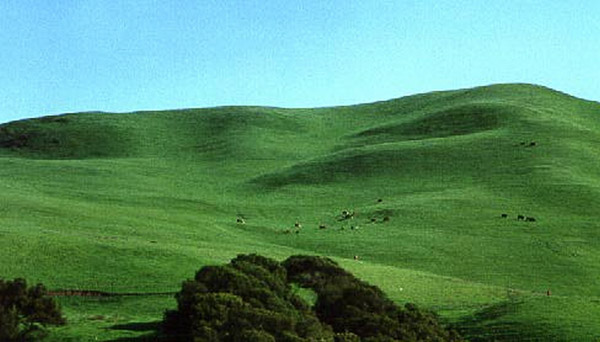
View from car along I-80
If you have read to the end, thank you. I hope you enjoyed the photos and descriptions, I certainly enjoyed the trip!